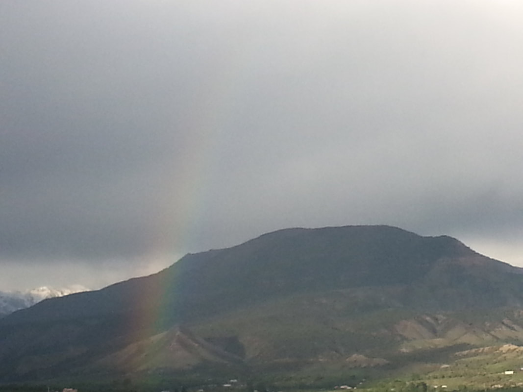
 Jumbo Mountain from Pitkin Mesa (Made summit on 09-30-2019) Jumbo seemed the obvious choice for my 8-er. It’s one of the most visually prominent land features around Paonia. Its western side presents dry, Juniper scrub and enticing red cliffs to our valley’s residents. This side is accessible via a system of trails winding out of the Apple Valley neighborhood. It’s a popular mountain biking area. One section of cliffs has been said to look like a face wearing sunglasses, though I had interpreted it as a goddess figure from certain angles. Either way, the mountain has personality. From town Jumbo has some communications towers plainly visible on what looks like the top. This was a promising clue as my climbing partner and I were working out a route to the summit. If there are towers up there, Julia and I decided, there must be a way up. 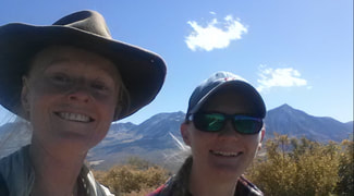 Let me back up. I mentioned the trail system on the west side, right? Well, rumor had it we could get as high as the “Grassy Knoll” on trail, and maybe we could scramble to the summit from there. It sounded difficult, uncertain, and possibly treacherous. Hmmm… DeLorme’s Atlas of Colorado shows some sort of trail going up from the road out past Minnesota Reservoir. The Atlas is not super detailed and sometimes is unclear as to what exactly sort of path we are talking about. However, if my calculations were correct, we could head up that way and follow trails all the way. It could be long, but it was unlikely to be dangerous. We couldn’t seem to find anyone who had actually been to the top. “How can something so popular be so mysterious?!” asked Julia. The Forest Service office was no help. We couldn’t find a map that showed more pertinent information. This was going to require some reconnaissance. 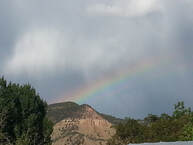 We set out on the first mutual day off we could muster. A rainbow touched the mountain from our starting point and seemed to bless our intention. Here’s where the interpersonal part of the terrain made things interesting. I had once driven my little car as far as the Minnesota Reservoir, but it was not a feat I cared to repeat as far as the road conditions were concerned. J’s car is far better for this sort of driving, but it’s not a 4X4, and I knew she tends to be more careful of her car than I am.  Since I didn’t know what shape the road is in beyond the reservoir, I suggested we park there and try a trail I had partway explored before. It led up a draw above the reservoir and looked on the map like it would intersect the main summit trail. If so it would also cut off some of our hiking distance. Well. We put in a good effort, but we didn’t ever find that “summit trail”. Our trail petered out into braided ribbons of game trails and enough dense brush to have J’s inner-dad-voice warning of hidden bears. We turned back. It looked like Jumbo was not one to reveal its secrets to the faint of heart. “It’s going to make us work for it,” said Julia.  It was several weeks before we found another workable day. Again the interpersonal terrain came into play. I had suggested a joint expedition between Julia and I and a couple of friends: C and S. Okay, so I admit part of the reason I proposed a joint expedition was in hopes that we could use their truck, in case the road got worse. Awkwardly, however, C ended up having a schedule conflict but said S was still up for coming along. So we became a trio for the one exception to me duo-climb perameter. (I explained our predicament to S and held faith that at some point on the way up we would “just know” it was time to separate so Julia and I could have our duo-summit.) Turns out we couldn’t have used their truck anyway. Der.
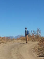
Still it was nice to have S along. We talked about the cliffs appearing as either a face or a goddess. Julia said she always felt a masculine presence from this mountain, while mountains and the land in general have a feminine presence. During this gender-fluid conversation it started to seem appropriate that I had both a male and a female climbing partner along. I relaxed into the inevitability of what was. Okay then. 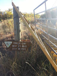 There were some other amusing details adding to the overall mystery. Just before we set out, we finally talked to someone who’d been up — on an ATV. This only served to further confuse things as he apparently didn’t remember well, telling us the road gets so bad he wouldn’t bring a Jeep on it. His advice to “stay left” was good though. We just didn’t know how far it was going to be, and when we came upon this sign, we got a little worried…. Did the decimal point fall off? 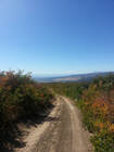 It turns out that what looked like a trail on the map was actually a road — a very good road — all the way to the summit. We parked probably four miles away expecting the road to get bad. Ha! But we did get our exercise. Only the summit itself was anticlimactic: a gentle rise in the road. Probably this explains why so few have been there. Turns out the towers are quite a bit lower than the top. Now we know.
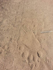
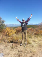
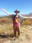
It was a lovely autumn day, Aspens turning and everything. Great views all around. Julia and I both found our homes from the mountain’s-eye view, adding to our internal maps of place relationships. 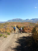 I found it interesting to notice how difference in elevation can seem greater when looking down than when looking up. After the summit ritual of song, photos and offerings, we took a brief rest and snack break and started our descent. 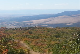 View homeward from the summit My listening with this Peak had given me to walk softly and go slowly, to be in contact with every step along the way. I wore my elk skin moccasins and did my best to slow down. I considered walking in silence, but it felt more in the flow to allow the meandering of our conversation. It also felt like our chatter would alert any animals of our presence and avoid startling Julia’s bear. (We saw a variety of tracks.) It was good to feel my feet upon the earth. The rest of my offering I keep between me and the mountain. 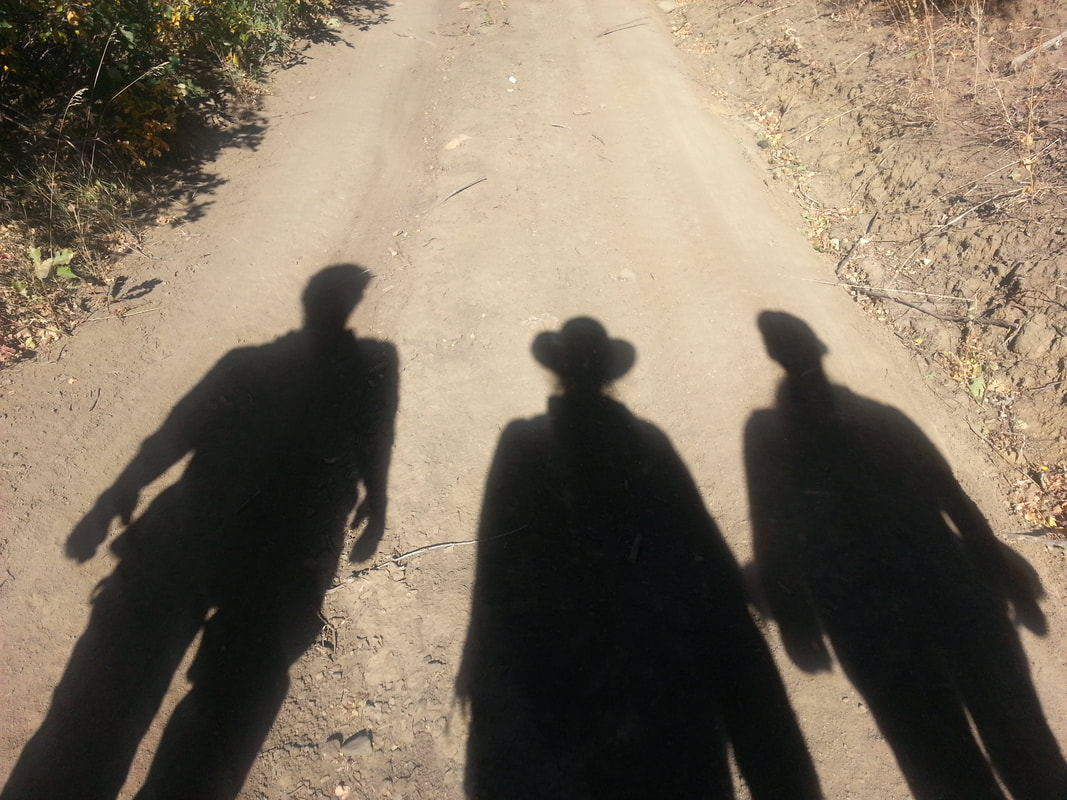
0 Comments
Leave a Reply. |
Amber DarkriverI am a collaborative experiential artist residing in Paonia, Colorado. Check out my Artist Manifesto! Archives
January 2020
Categories |
 RSS Feed
